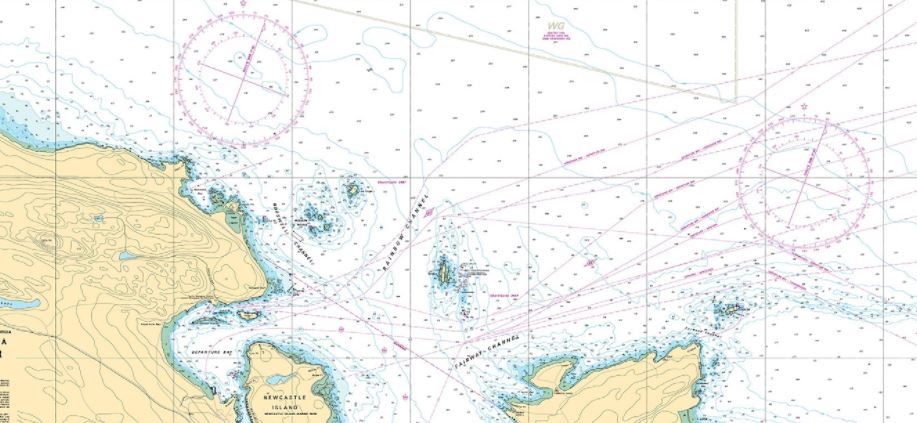
 Nautical charts (marine charts) are a useful source of information to boaters, especially on water depth, the type of bottom, the type of shoreline, current direction, coastal altitude, easily identifiable landmarks, and aids to navigation.
Before you travel in a new area, make sure you only use the most recent and up to date nautical charts available to determine whether you will encounter any overhead or underwater hazards. Obtain as much information as possible on the area that you plan to visit in your boat.
Reading marine charts in conjunction with other publications such as Sailing Directions and/or with tide and current tables will indicate water depths, times of low, slack, and high tides, and the direction and rates of flow.
- The Canadian Hydrographic Service publishes marine charts to help boaters with navigation.
- The Canadian Hydrographic Service also publishes the Canadian Tide and Current tables.
- The Canadian Tide and Current Tables provide information about tides, as well as direction and rates of water flow.
Fisheries and Oceans Canada publishes a wide range of information to help boaters understand their marine charts. - Sailing Directions is a valuable free publication produced through the Canadian Hydrographic Service. This publication provides additional information not always shown on nautical charts.
- Charts and Cruising Guides will help you identify places to take shelter in event of foul weather
To know which regional chart is most appropriate for your activity, consult the Canadian Hydrographic Service’s Nautical Chart Catalogue. This catalogue is a large map showing the area covered by each available chart. For information on how to obtain charts, visit the Canadian Hydrographic Service website: www.charts.gc.ca
To help make navigation safer, the law requires you to carry the following for each area you plan to boat in:
- The latest edition of the largest scale nautical chart (when available); and
- The latest edition of related documents and publications, including Notices to Mariners, Sailing Directions, tide and current tables, and the List of Lights, Buoys and Fog Signals.
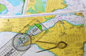
You must be able to plot your position/course and read the chart symbols (i.e. dangers, buoys etc.).
The documents, charts and publications may not be necessary if your boat weighs less than 100 tons and that you have sufficient knowledge of the waterways including:
- Shipping routes;
- Lights, buoys and marks;
- Boating hazards; and
- Boating conditions, such as tides, currents, ice and weather patterns.
If you are boating in an area not covered by marine charts, ask knowledgeable local residents for information on potential water hazards such as low-head dams, white water, and shoals.
If you are using GPS and/or electronic charts, always keep paper charts on board as a backup.